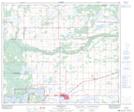
Maps showing Bonnyville, 7,18-61-5-W4, Alberta
Bonnyville is a Town located in 7,18-61-5-W4, Alberta and has an elevation of 554 meters.
- Latitude: 54° 16' 2'' North (decimal: 54.2672222)
- Longitude: 110° 44' 19'' West (decimal: -110.7386110)
- Topography Feature Category: Town
- Geographical Feature: Town
- Canadian Province/Territory: Alberta
- Elevation: 554 meters
- Location: 7,18-61-5-W4
- Atlas of Canada Locator Map: Bonnyville
- GPS Coordinate Locator Map: Bonnyville Lat/Long
Bonnyville NTS Map Sheets