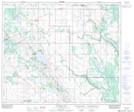
Maps showing Boscombe, 4-60-10-W4, Alberta
Boscombe is a Unincorporated area located in 4-60-10-W4, Alberta and has an elevation of 646 meters.
- Latitude: 54° 9' 8'' North (decimal: 54.1522222)
- Longitude: 111° 26' 4'' West (decimal: -111.4344443)
- Topography Feature Category: Unincorporated area
- Geographical Feature: Railway Point
- Canadian Province/Territory: Alberta
- Elevation: 646 meters
- Location: 4-60-10-W4
- Atlas of Canada Locator Map: Boscombe
- GPS Coordinate Locator Map: Boscombe Lat/Long
Boscombe NTS Map Sheets