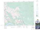
Maps showing Sawback Creek, 28-13-W5, Alberta
Sawback Creek is a River located in 28-13-W5, Alberta and has an elevation of 1866 meters.
- Latitude: 51° 24' 22'' North (decimal: 51.4061111)
- Longitude: 115° 45' 30'' West (decimal: -115.7583333)
- Topography Feature Category: River
- Geographical Feature: Creek
- Canadian Province/Territory: Alberta
- Elevation: 1866 meters
- Location: 28-13-W5
- Atlas of Canada Locator Map: Sawback Creek
- GPS Coordinate Locator Map: Sawback Creek Lat/Long
Sawback Creek NTS Map Sheets