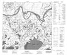
Maps showing Sawmill Island, 114-10-W4, Alberta
Sawmill Island is a Island located in 114-10-W4, Alberta and has an elevation of 212 meters.
- Latitude: 58° 55' 8'' North (decimal: 58.9188888)
- Longitude: 111° 38' 16'' West (decimal: -111.6377777)
- Topography Feature Category: Island
- Geographical Feature: Island
- Canadian Province/Territory: Alberta
- Elevation: 212 meters
- Location: 114-10-W4
- Atlas of Canada Locator Map: Sawmill Island
- GPS Coordinate Locator Map: Sawmill Island Lat/Long
Sawmill Island NTS Map Sheets