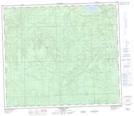
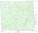
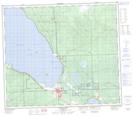
Maps showing Sawridge Creek, 5-73-5-W5, Alberta
Sawridge Creek is a River located in 5-73-5-W5, Alberta and has an elevation of 716 meters.
- Latitude: 55° 17' 41'' North (decimal: 55.2947222)
- Longitude: 114° 44' 3'' West (decimal: -114.7341666)
- Topography Feature Category: River
- Geographical Feature: Creek
- Canadian Province/Territory: Alberta
- Elevation: 716 meters
- Location: 5-73-5-W5
- Atlas of Canada Locator Map: Sawridge Creek
- GPS Coordinate Locator Map: Sawridge Creek Lat/Long
Sawridge Creek NTS Map Sheets