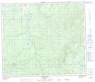
Maps showing Sawridge Hill, 72-7-W5, Alberta
Sawridge Hill is a Mountain located in 72-7-W5, Alberta and has an elevation of 1029 meters.
- Latitude: 55° 12' 27'' North (decimal: 55.2074999)
- Longitude: 115° 1' 22'' West (decimal: -115.0227778)
- Topography Feature Category: Mountain
- Geographical Feature: Hill
- Canadian Province/Territory: Alberta
- Elevation: 1029 meters
- Location: 72-7-W5
- Atlas of Canada Locator Map: Sawridge Hill
- GPS Coordinate Locator Map: Sawridge Hill Lat/Long
Sawridge Hill NTS Map Sheets