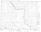
Maps showing Scandia, 19-15-15-W4, Alberta
Scandia is a Unincorporated area located in 19-15-15-W4, Alberta and has an elevation of 765 meters.
- Latitude: 50° 16' 41'' North (decimal: 50.2780555)
- Longitude: 112° 2' 48'' West (decimal: -112.0466667)
- Topography Feature Category: Unincorporated area
- Geographical Feature: Hamlet
- Canadian Province/Territory: Alberta
- Elevation: 765 meters
- Location: 19-15-15-W4
- Atlas of Canada Locator Map: Scandia
- GPS Coordinate Locator Map: Scandia Lat/Long