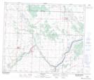
Maps showing Scotford, 20-55-21-W4, Alberta
Scotford is a Unincorporated area located in 20-55-21-W4, Alberta and has an elevation of 631 meters.
- Latitude: 53° 45' 41'' North (decimal: 53.7613888)
- Longitude: 113° 5' 5'' West (decimal: -113.0847221)
- Topography Feature Category: Unincorporated area
- Geographical Feature: Locality
- Canadian Province/Territory: Alberta
- Elevation: 631 meters
- Location: 20-55-21-W4
- Atlas of Canada Locator Map: Scotford
- GPS Coordinate Locator Map: Scotford Lat/Long