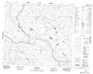
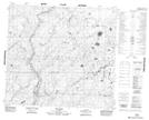
Maps showing Seaforth Creek, 2-91-24-W4, Alberta
Seaforth Creek is a River located in 2-91-24-W4, Alberta.
- Latitude: 56° 51' 35'' North (decimal: 56.8597222)
- Longitude: 113° 44' 36'' West (decimal: -113.7433333)
- Topography Feature Category: River
- Geographical Feature: Creek
- Canadian Province/Territory: Alberta
- Location: 2-91-24-W4
- Atlas of Canada Locator Map: Seaforth Creek
- GPS Coordinate Locator Map: Seaforth Creek Lat/Long
Seaforth Creek NTS Map Sheets