Maps showing Sedgewick, 9-44-12-W4, Alberta
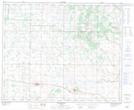
Sedgewick is a Town located in 9-44-12-W4, Alberta and has an elevation of 669 meters.
- Latitude: 52° 46' 29'' North (decimal: 52.7747222)
- Longitude: 111° 41' 34'' West (decimal: -111.6927778)
- Topography Feature Category: Town
- Geographical Feature: Town
- Canadian Province/Territory: Alberta
- Elevation: 669 meters
- Location: 9-44-12-W4
- Atlas of Canada Locator Map: Sedgewick
- GPS Coordinate Locator Map: Sedgewick Lat/Long
Sedgewick NTS Map Sheets