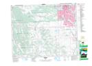
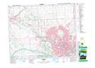
Maps showing Glenmore Reservoir, 23-1-W5, Alberta
Glenmore Reservoir is a Lake located in 23-1-W5, Alberta and has an elevation of 1081 meters.
- Latitude: 50° 59' 21'' North (decimal: 50.9891666)
- Longitude: 114° 6' 49'' West (decimal: -114.1136111)
- Topography Feature Category: Lake
- Geographical Feature: Reservoir
- Canadian Province/Territory: Alberta
- Elevation: 1081 meters
- Location: 23-1-W5
- Atlas of Canada Locator Map: Glenmore Reservoir
- GPS Coordinate Locator Map: Glenmore Reservoir Lat/Long
Glenmore Reservoir NTS Map Sheets