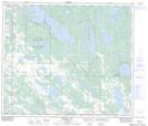
Maps showing Grandeur Lake, 5-64-12-W4, Alberta
Grandeur Lake is a Lake located in 5-64-12-W4, Alberta and has an elevation of 590 meters.
- Latitude: 54° 30' 43'' North (decimal: 54.5119444)
- Longitude: 111° 47' 15'' West (decimal: -111.7874999)
- Topography Feature Category: Lake
- Geographical Feature: Lake
- Canadian Province/Territory: Alberta
- Elevation: 590 meters
- Location: 5-64-12-W4
- Atlas of Canada Locator Map: Grandeur Lake
- GPS Coordinate Locator Map: Grandeur Lake Lat/Long
Grandeur Lake NTS Map Sheets