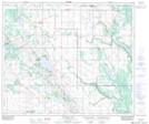
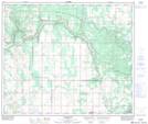
Maps showing Grassy Island Lake, 61-10-W4, Alberta
Grassy Island Lake is a Lake located in 61-10-W4, Alberta and has an elevation of 626 meters.
- Latitude: 54° 15' 9'' North (decimal: 54.2524999)
- Longitude: 111° 22' 52'' West (decimal: -111.3811111)
- Topography Feature Category: Lake
- Geographical Feature: Lake
- Canadian Province/Territory: Alberta
- Elevation: 626 meters
- Location: 61-10-W4
- Atlas of Canada Locator Map: Grassy Island Lake
- GPS Coordinate Locator Map: Grassy Island Lake Lat/Long
Grassy Island Lake NTS Map Sheets