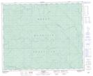
Maps showing Grey Owl Creek, 43-13-W5, Alberta
Grey Owl Creek is a River located in 43-13-W5, Alberta and has an elevation of 1179 meters.
- Latitude: 52° 44' 38'' North (decimal: 52.7438889)
- Longitude: 115° 47' 10'' West (decimal: -115.7861110)
- Topography Feature Category: River
- Geographical Feature: Creek
- Canadian Province/Territory: Alberta
- Elevation: 1179 meters
- Location: 43-13-W5
- Atlas of Canada Locator Map: Grey Owl Creek
- GPS Coordinate Locator Map: Grey Owl Creek Lat/Long
Grey Owl Creek NTS Map Sheets