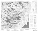
Maps showing Greywillow Point, 118-1-W4, Alberta
Greywillow Point is a Cape located in 118-1-W4, Alberta and has an elevation of 209 meters.
- Latitude: 59° 16' 58'' North (decimal: 59.2827777)
- Longitude: 110° 2' 38'' West (decimal: -110.0438889)
- Topography Feature Category: Cape
- Geographical Feature: Point
- Canadian Province/Territory: Alberta
- Elevation: 209 meters
- Location: 118-1-W4
- Atlas of Canada Locator Map: Greywillow Point
- GPS Coordinate Locator Map: Greywillow Point Lat/Long
Greywillow Point NTS Map Sheets