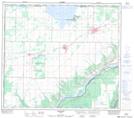
Maps showing Grimshaw, 17-83-23-W5, Alberta
Grimshaw is a Town located in 17-83-23-W5, Alberta and has an elevation of 609 meters.
- Latitude: 56° 11' 19'' North (decimal: 56.1886111)
- Longitude: 117° 36' 21'' West (decimal: -117.6058333)
- Topography Feature Category: Town
- Geographical Feature: Town
- Canadian Province/Territory: Alberta
- Elevation: 609 meters
- Location: 17-83-23-W5
- Atlas of Canada Locator Map: Grimshaw
- GPS Coordinate Locator Map: Grimshaw Lat/Long
Grimshaw NTS Map Sheets