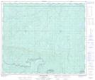
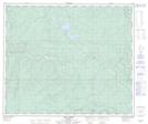
Maps showing Grizzly, 10-61-22-W5, Alberta
Grizzly is a Unincorporated area located in 10-61-22-W5, Alberta.
- Latitude: 54° 15' 00'' North (decimal: 54.2499999)
- Longitude: 117° 12' 30'' West (decimal: -117.2083333)
- Topography Feature Category: Unincorporated area
- Geographical Feature: Railway Point
- Canadian Province/Territory: Alberta
- Location: 10-61-22-W5
- Atlas of Canada Locator Map: Grizzly
- GPS Coordinate Locator Map: Grizzly Lat/Long
Grizzly NTS Map Sheets