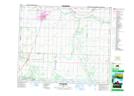
Maps showing Gwynne, 24-46-23-W4, Alberta
Gwynne is a Unincorporated area located in 24-46-23-W4, Alberta and has an elevation of 722 meters.
- Latitude: 52° 59' 12'' North (decimal: 52.9866666)
- Longitude: 113° 11' 56'' West (decimal: -113.1988889)
- Topography Feature Category: Unincorporated area
- Geographical Feature: Hamlet
- Canadian Province/Territory: Alberta
- Elevation: 722 meters
- Location: 24-46-23-W4
- Atlas of Canada Locator Map: Gwynne
- GPS Coordinate Locator Map: Gwynne Lat/Long
Gwynne NTS Map Sheets