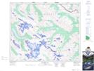
Maps showing Mount Mary Vaux, 41-24-25-W5, Alberta
Mount Mary Vaux is a Mountain located in 41-24-25-W5, Alberta and has an elevation of 2770 meters.
- Latitude: 52° 33' 32'' North (decimal: 52.5588889)
- Longitude: 117° 27' 11'' West (decimal: -117.4530556)
- Topography Feature Category: Mountain
- Geographical Feature: Mount
- Canadian Province/Territory: Alberta
- Elevation: 2770 meters
- Location: 41-24-25-W5
- Atlas of Canada Locator Map: Mount Mary Vaux
- GPS Coordinate Locator Map: Mount Mary Vaux Lat/Long
Mount Mary Vaux NTS Map Sheets