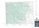
Maps showing Mayme Coulée, 29-6-W5, Alberta
Mayme Coulée is a Valley located in 29-6-W5, Alberta and has an elevation of 1256 meters.
- Latitude: 51° 28' 48'' North (decimal: 51.4800000)
- Longitude: 114° 43' 38'' West (decimal: -114.7272221)
- Topography Feature Category: Valley
- Geographical Feature: Coulée
- Canadian Province/Territory: Alberta
- Elevation: 1256 meters
- Location: 29-6-W5
- Atlas of Canada Locator Map: Mayme Coulée
- GPS Coordinate Locator Map: Mayme Coulée Lat/Long
Mayme Coulée NTS Map Sheets