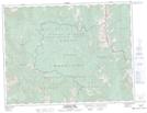
Maps showing Mount McCarty, 17-5-4-W5, Alberta
Mount McCarty is a Mountain located in 17-5-4-W5, Alberta and has an elevation of 2149 meters.
- Latitude: 49° 23' 4'' North (decimal: 49.3844444)
- Longitude: 114° 30' 2'' West (decimal: -114.5005555)
- Topography Feature Category: Mountain
- Geographical Feature: Mount
- Canadian Province/Territory: Alberta
- Elevation: 2149 meters
- Location: 17-5-4-W5
- Atlas of Canada Locator Map: Mount McCarty
- GPS Coordinate Locator Map: Mount McCarty Lat/Long
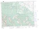
Mount McCarty NTS Map Sheets