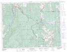
Maps showing McGillivray Creek, 8-8-4-W5, Alberta
McGillivray Creek is a River located in 8-8-4-W5, Alberta and has an elevation of 1462 meters.
- Latitude: 49° 37' 54'' North (decimal: 49.6316666)
- Longitude: 114° 31' 12'' West (decimal: -114.5199999)
- Topography Feature Category: River
- Geographical Feature: Creek
- Canadian Province/Territory: Alberta
- Elevation: 1462 meters
- Location: 8-8-4-W5
- Atlas of Canada Locator Map: McGillivray Creek
- GPS Coordinate Locator Map: McGillivray Creek Lat/Long