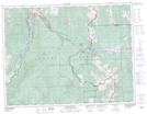
Maps showing McGillivray Ridge, 8-4-W5, Alberta
McGillivray Ridge is a Mountain located in 8-4-W5, Alberta and has an elevation of 2055 meters.
- Latitude: 49° 43' 55'' North (decimal: 49.7319444)
- Longitude: 114° 30' 12'' West (decimal: -114.5033333)
- Topography Feature Category: Mountain
- Geographical Feature: Ridge
- Canadian Province/Territory: Alberta
- Elevation: 2055 meters
- Location: 8-4-W5
- Atlas of Canada Locator Map: McGillivray Ridge
- GPS Coordinate Locator Map: McGillivray Ridge Lat/Long