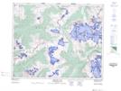
Maps showing McGillivray Ridge, 39,40-2-W6, Alberta
McGillivray Ridge is a Mountain located in 39,40-2-W6, Alberta and has an elevation of 2129 meters.
- Latitude: 52° 23' 34'' North (decimal: 52.3927777)
- Longitude: 118° 10' 37'' West (decimal: -118.1769443)
- Topography Feature Category: Mountain
- Geographical Feature: Ridge
- Canadian Province/Territory: Alberta
- Elevation: 2129 meters
- Location: 39,40-2-W6
- Atlas of Canada Locator Map: McGillivray Ridge
- GPS Coordinate Locator Map: McGillivray Ridge Lat/Long
McGillivray Ridge NTS Map Sheets