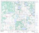
Maps showing Boyne Lake, 1-61-12-W4, Alberta
Boyne Lake is a Unincorporated area located in 1-61-12-W4, Alberta and has an elevation of 622 meters.
- Latitude: 54° 14' 17'' North (decimal: 54.2380555)
- Longitude: 111° 40' 39'' West (decimal: -111.6774999)
- Topography Feature Category: Unincorporated area
- Geographical Feature: Locality
- Canadian Province/Territory: Alberta
- Elevation: 622 meters
- Location: 1-61-12-W4
- Atlas of Canada Locator Map: Boyne Lake
- GPS Coordinate Locator Map: Boyne Lake Lat/Long
Boyne Lake NTS Map Sheets