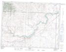
Maps showing Bratton Coulee, 10-9-29-W4, Alberta
Bratton Coulee is a Valley located in 10-9-29-W4, Alberta and has an elevation of 1269 meters.
- Latitude: 49° 43' 17'' North (decimal: 49.7213888)
- Longitude: 113° 50' 37'' West (decimal: -113.8436110)
- Topography Feature Category: Valley
- Geographical Feature: Coulee
- Canadian Province/Territory: Alberta
- Elevation: 1269 meters
- Location: 10-9-29-W4
- Atlas of Canada Locator Map: Bratton Coulee
- GPS Coordinate Locator Map: Bratton Coulee Lat/Long