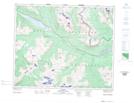
Maps showing Mount Bridgland, 46-4-W6, Alberta
Mount Bridgland is a Mountain located in 46-4-W6, Alberta and has an elevation of 2416 meters.
- Latitude: 52° 57' 11'' North (decimal: 52.9530555)
- Longitude: 118° 31' 33'' West (decimal: -118.5258332)
- Topography Feature Category: Mountain
- Geographical Feature: Mount
- Canadian Province/Territory: Alberta
- Elevation: 2416 meters
- Location: 46-4-W6
- Atlas of Canada Locator Map: Mount Bridgland
- GPS Coordinate Locator Map: Mount Bridgland Lat/Long
Mount Bridgland NTS Map Sheets