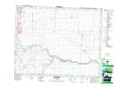
Maps showing Shepard, 18-23-28-W4, Alberta
Shepard is a Unincorporated area located in 18-23-28-W4, Alberta and has an elevation of 1025 meters.
- Latitude: 50° 57' 7'' North (decimal: 50.9519444)
- Longitude: 113° 54' 35'' West (decimal: -113.9097221)
- Topography Feature Category: Unincorporated area
- Geographical Feature: Hamlet
- Canadian Province/Territory: Alberta
- Elevation: 1025 meters
- Location: 18-23-28-W4
- Atlas of Canada Locator Map: Shepard
- GPS Coordinate Locator Map: Shepard Lat/Long