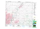
Maps showing Sherwood Park, 27-52-23-W4, Alberta
Sherwood Park is a Unincorporated area located in 27-52-23-W4, Alberta and has an elevation of 726 meters.
- Latitude: 53° 32' 2'' North (decimal: 53.5338889)
- Longitude: 113° 17' 25'' West (decimal: -113.2902778)
- Topography Feature Category: Unincorporated area
- Geographical Feature: Urban Community
- Canadian Province/Territory: Alberta
- Elevation: 726 meters
- Location: 27-52-23-W4
- Atlas of Canada Locator Map: Sherwood Park
- GPS Coordinate Locator Map: Sherwood Park Lat/Long