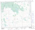
Maps showing Shoal Creek, 28-61-2-W5, Alberta
Shoal Creek is a Unincorporated area located in 28-61-2-W5, Alberta and has an elevation of 626 meters.
- Latitude: 54° 18' North (decimal: 54.2999999)
- Longitude: 114° 14' West (decimal: -114.2333332)
- Topography Feature Category: Unincorporated area
- Geographical Feature: Locality
- Canadian Province/Territory: Alberta
- Elevation: 626 meters
- Location: 28-61-2-W5
- Atlas of Canada Locator Map: Shoal Creek
- GPS Coordinate Locator Map: Shoal Creek Lat/Long
Shoal Creek NTS Map Sheets