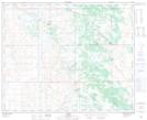
Maps showing Shorncliffe Lake, 40-6,7-W4, Alberta
Shorncliffe Lake is a Lake located in 40-6,7-W4, Alberta and has an elevation of 674 meters.
- Latitude: 52° 28' 35'' North (decimal: 52.4763888)
- Longitude: 110° 52' 47'' West (decimal: -110.8797221)
- Topography Feature Category: Lake
- Geographical Feature: Lake
- Canadian Province/Territory: Alberta
- Elevation: 674 meters
- Location: 40-6,7-W4
- Atlas of Canada Locator Map: Shorncliffe Lake
- GPS Coordinate Locator Map: Shorncliffe Lake Lat/Long