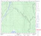
Maps showing Shott Island, 22,27,34-100-9-W4, Alberta
Shott Island is a Island located in 22,27,34-100-9-W4, Alberta and has an elevation of 226 meters.
- Latitude: 57° 42' 22'' North (decimal: 57.7061111)
- Longitude: 111° 23' 22'' West (decimal: -111.3894443)
- Topography Feature Category: Island
- Geographical Feature: Island
- Canadian Province/Territory: Alberta
- Elevation: 226 meters
- Location: 22,27,34-100-9-W4
- Atlas of Canada Locator Map: Shott Island
- GPS Coordinate Locator Map: Shott Island Lat/Long
Shott Island NTS Map Sheets