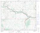
Maps showing Sidcup, 30-46-3-W4, Alberta
Sidcup is a Unincorporated area located in 30-46-3-W4, Alberta and has an elevation of 687 meters.
- Latitude: 52° 59' 41'' North (decimal: 52.9947222)
- Longitude: 110° 25' 4'' West (decimal: -110.4177778)
- Topography Feature Category: Unincorporated area
- Geographical Feature: Locality
- Canadian Province/Territory: Alberta
- Elevation: 687 meters
- Location: 30-46-3-W4
- Atlas of Canada Locator Map: Sidcup
- GPS Coordinate Locator Map: Sidcup Lat/Long
Sidcup NTS Map Sheets