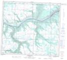
Maps showing Silver Valley, 24-81-11-W6, Alberta
Silver Valley is a Unincorporated area located in 24-81-11-W6, Alberta and has an elevation of 673 meters.
- Latitude: 56° 2' 34'' North (decimal: 56.0427777)
- Longitude: 119° 34' 8'' West (decimal: -119.5688888)
- Topography Feature Category: Unincorporated area
- Geographical Feature: Locality
- Canadian Province/Territory: Alberta
- Elevation: 673 meters
- Location: 24-81-11-W6
- Atlas of Canada Locator Map: Silver Valley
- GPS Coordinate Locator Map: Silver Valley Lat/Long
Silver Valley NTS Map Sheets