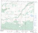
Maps showing Silverwood, 20-77-5-W6, Alberta
Silverwood is a Unincorporated area located in 20-77-5-W6, Alberta and has an elevation of 638 meters.
- Latitude: 55° 40' 41'' North (decimal: 55.6780556)
- Longitude: 118° 43' 32'' West (decimal: -118.7255556)
- Topography Feature Category: Unincorporated area
- Geographical Feature: Locality
- Canadian Province/Territory: Alberta
- Elevation: 638 meters
- Location: 20-77-5-W6
- Atlas of Canada Locator Map: Silverwood
- GPS Coordinate Locator Map: Silverwood Lat/Long
Silverwood NTS Map Sheets