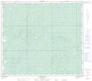
Maps showing Simon Lakes, 29-86-17-W5, Alberta
Simon Lakes is a Unincorporated area located in 29-86-17-W5, Alberta and has an elevation of 619 meters.
- Latitude: 56° 28' 51'' North (decimal: 56.4808332)
- Longitude: 116° 38' 17'' West (decimal: -116.6380556)
- Topography Feature Category: Unincorporated area
- Geographical Feature: Locality
- Canadian Province/Territory: Alberta
- Elevation: 619 meters
- Location: 29-86-17-W5
- Atlas of Canada Locator Map: Simon Lakes
- GPS Coordinate Locator Map: Simon Lakes Lat/Long
Simon Lakes NTS Map Sheets