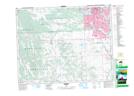
Maps showing Six Mile Coulee, 23-2-W5, Alberta
Six Mile Coulee is a Valley located in 23-2-W5, Alberta and has an elevation of 1102 meters.
- Latitude: 50° 55' 50'' North (decimal: 50.9306940)
- Longitude: 114° 12' 12'' West (decimal: -114.2032200)
- Topography Feature Category: Valley
- Geographical Feature: Coulee
- Canadian Province/Territory: Alberta
- Elevation: 1102 meters
- Location: 23-2-W5
- Atlas of Canada Locator Map: Six Mile Coulee
- GPS Coordinate Locator Map: Six Mile Coulee Lat/Long
Six Mile Coulee NTS Map Sheets