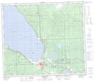
Maps showing Slave Lake, 31-72-5-W5, Alberta
Slave Lake is a Town located in 31-72-5-W5, Alberta and has an elevation of 583 meters.
- Latitude: 55° 16' 56'' North (decimal: 55.2822222)
- Longitude: 114° 46' 13'' West (decimal: -114.7702778)
- Topography Feature Category: Town
- Geographical Feature: Town
- Canadian Province/Territory: Alberta
- Elevation: 583 meters
- Location: 31-72-5-W5
- Atlas of Canada Locator Map: Slave Lake
- GPS Coordinate Locator Map: Slave Lake Lat/Long
Slave Lake NTS Map Sheets