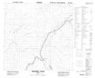
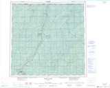
Maps showing Slavey Creek, 4-118-21-W5, Alberta
Slavey Creek is a Unincorporated area located in 4-118-21-W5, Alberta and has an elevation of 326 meters.
- Latitude: 59° 11' 39'' North (decimal: 59.1941666)
- Longitude: 117° 29' 36'' West (decimal: -117.4933332)
- Topography Feature Category: Unincorporated area
- Geographical Feature: Locality
- Canadian Province/Territory: Alberta
- Elevation: 326 meters
- Location: 4-118-21-W5
- Atlas of Canada Locator Map: Slavey Creek
- GPS Coordinate Locator Map: Slavey Creek Lat/Long
Slavey Creek NTS Map Sheets