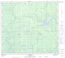
Maps showing Haig Lake, 91-13,14-W5, Alberta
Haig Lake is a Lake located in 91-13,14-W5, Alberta and has an elevation of 733 meters.
- Latitude: 56° 53' 54'' North (decimal: 56.8983332)
- Longitude: 116° 5' 54'' West (decimal: -116.0983333)
- Topography Feature Category: Lake
- Geographical Feature: Lake
- Canadian Province/Territory: Alberta
- Elevation: 733 meters
- Location: 91-13,14-W5
- Atlas of Canada Locator Map: Haig Lake
- GPS Coordinate Locator Map: Haig Lake Lat/Long
Haig Lake NTS Map Sheets