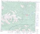
Maps showing Mount Hamell, 57-9-W6, Alberta
Mount Hamell is a Mountain located in 57-9-W6, Alberta and has an elevation of 1939 meters.
- Latitude: 53° 58' 23'' North (decimal: 53.9730555)
- Longitude: 119° 12' 31'' West (decimal: -119.2086110)
- Topography Feature Category: Mountain
- Geographical Feature: Mount
- Canadian Province/Territory: Alberta
- Elevation: 1939 meters
- Location: 57-9-W6
- Atlas of Canada Locator Map: Mount Hamell
- GPS Coordinate Locator Map: Mount Hamell Lat/Long
Mount Hamell NTS Map Sheets