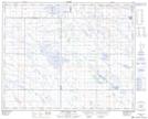
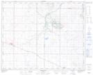
Maps showing Hamilton Lake, 12-35-9,10-W4, Alberta
Hamilton Lake is a Lake located in 12-35-9,10-W4, Alberta and has an elevation of 769 meters.
- Latitude: 51° 59' North (decimal: 51.9833000)
- Longitude: 111° 19' West (decimal: -111.3166999)
- Topography Feature Category: Lake
- Geographical Feature: Lake
- Canadian Province/Territory: Alberta
- Elevation: 769 meters
- Location: 12-35-9,10-W4
- GPS Coordinate Locator Map: Hamilton Lake Lat/Long
Hamilton Lake NTS Map Sheets