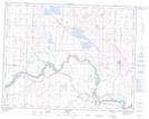
Maps showing Hammer Hill, 23-23-W4, Alberta
Hammer Hill is a Mountain located in 23-23-W4, Alberta and has an elevation of 979 meters.
- Latitude: 50° 57' 10'' North (decimal: 50.9527778)
- Longitude: 113° 8' 36'' West (decimal: -113.1433333)
- Topography Feature Category: Mountain
- Geographical Feature: Hill
- Canadian Province/Territory: Alberta
- Elevation: 979 meters
- Location: 23-23-W4
- Atlas of Canada Locator Map: Hammer Hill
- GPS Coordinate Locator Map: Hammer Hill Lat/Long