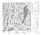
Maps showing Harker Lake, 126-2-W4, Alberta
Harker Lake is a Lake located in 126-2-W4, Alberta and has an elevation of 355 meters.
- Latitude: 59° 59' 18'' North (decimal: 59.9883333)
- Longitude: 110° 14' 48'' West (decimal: -110.2466666)
- Topography Feature Category: Lake
- Geographical Feature: Lake
- Canadian Province/Territory: Alberta
- Elevation: 355 meters
- Location: 126-2-W4
- Atlas of Canada Locator Map: Harker Lake
- GPS Coordinate Locator Map: Harker Lake Lat/Long
Harker Lake NTS Map Sheets