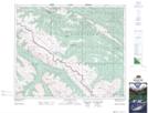
Maps showing Harlequin Creek, 46-24-W5, Alberta
Harlequin Creek is a River located in 46-24-W5, Alberta and has an elevation of 2027 meters.
- Latitude: 52° 59' 29'' North (decimal: 52.9913889)
- Longitude: 117° 27' 0'' West (decimal: -117.4500000)
- Topography Feature Category: River
- Geographical Feature: Creek
- Canadian Province/Territory: Alberta
- Elevation: 2027 meters
- Location: 46-24-W5
- Atlas of Canada Locator Map: Harlequin Creek
- GPS Coordinate Locator Map: Harlequin Creek Lat/Long
Harlequin Creek NTS Map Sheets