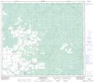
Maps showing Harmon Valley, 12-82-19-W5, Alberta
Harmon Valley is a Unincorporated area located in 12-82-19-W5, Alberta and has an elevation of 622 meters.
- Latitude: 56° 5' 55'' North (decimal: 56.0986111)
- Longitude: 116° 50' 2'' West (decimal: -116.8338888)
- Topography Feature Category: Unincorporated area
- Geographical Feature: Locality
- Canadian Province/Territory: Alberta
- Elevation: 622 meters
- Location: 12-82-19-W5
- Atlas of Canada Locator Map: Harmon Valley
- GPS Coordinate Locator Map: Harmon Valley Lat/Long
Harmon Valley NTS Map Sheets