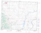
Maps showing Hartleyville, 5-5-27-W4, Alberta
Hartleyville is a Unincorporated area located in 5-5-27-W4, Alberta and has an elevation of 1168 meters.
- Latitude: 49° 21' 52'' North (decimal: 49.3644444)
- Longitude: 113° 36' 34'' West (decimal: -113.6094444)
- Topography Feature Category: Unincorporated area
- Geographical Feature: Hamlet
- Canadian Province/Territory: Alberta
- Elevation: 1168 meters
- Location: 5-5-27-W4
- Atlas of Canada Locator Map: Hartleyville
- GPS Coordinate Locator Map: Hartleyville Lat/Long
Hartleyville NTS Map Sheets