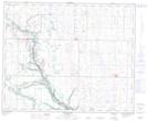
Maps showing Hastings Coulée, 9-41-16-W4, Alberta
Hastings Coulée is a Valley located in 9-41-16-W4, Alberta and has an elevation of 715 meters.
- Latitude: 52° 31' North (decimal: 52.5166999)
- Longitude: 112° 15' West (decimal: -112.2500000)
- Topography Feature Category: Valley
- Geographical Feature: Coulée
- Canadian Province/Territory: Alberta
- Elevation: 715 meters
- Location: 9-41-16-W4
- Atlas of Canada Locator Map: Hastings Coulée
- GPS Coordinate Locator Map: Hastings Coulée Lat/Long
Hastings Coulée NTS Map Sheets