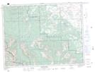
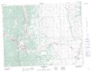
Maps showing Hastings Ridge, 6-4-W5, Alberta
Hastings Ridge is a Mountain located in 6-4-W5, Alberta and has an elevation of 1821 meters.
- Latitude: 49° 29' 19'' North (decimal: 49.4886111)
- Longitude: 114° 24' 48'' West (decimal: -114.4133333)
- Topography Feature Category: Mountain
- Geographical Feature: Ridge
- Canadian Province/Territory: Alberta
- Elevation: 1821 meters
- Location: 6-4-W5
- Atlas of Canada Locator Map: Hastings Ridge
- GPS Coordinate Locator Map: Hastings Ridge Lat/Long
Hastings Ridge NTS Map Sheets