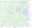
Maps showing Hawkins Lake, 80,81-12-W5, Alberta
Hawkins Lake is a Lake located in 80,81-12-W5, Alberta and has an elevation of 688 meters.
- Latitude: 55° 59' 46'' North (decimal: 55.9961111)
- Longitude: 115° 47' 39'' West (decimal: -115.7941666)
- Topography Feature Category: Lake
- Geographical Feature: Lake
- Canadian Province/Territory: Alberta
- Elevation: 688 meters
- Location: 80,81-12-W5
- Atlas of Canada Locator Map: Hawkins Lake
- GPS Coordinate Locator Map: Hawkins Lake Lat/Long
Hawkins Lake NTS Map Sheets